Research Projects
Graduate Research Highlights: Understanding the Sources, Pathways and Impacts of Road Salt (Chloride) on Aquatic Ecosystems
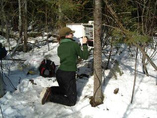
With chloride concentrations increasing in urban and urbanizing streams across North America due to the over-application of road salts to paved surfaces, the sources, transport and fate of chloride in aquatic ecosystems are of particular interest to Dr. Claire Oswald and the Watershed Hydrology Research Group. By applying field, laboratory, geospatial and computational methodologies in urban hydrology, Dr. Claire Oswald and her graduate students investigate the processes and pathways by which chloride enters the environment, seeking to improve watershed management and best management practices for the application of road salts.
The Watershed Hydrology Research Group's recent work includes the development and application of more statistically robust approaches to modelling using a Monte Carlo framework to estimate high-frequency chloride concentrations using surrogate water quality parameters (e.g., electrical conductivity), which have been applied to quantify annual exceedances of Canadian and U.S. water quality guidelines for chloride in sub-watersheds along the Niagara Escarpment in Hamilton, Ontario (Wyatt Weatherson), and calculate chloride loads from stormwater pipes in the Black and Lavender Creeks (Christopher Randall). Additional work has been undertaken to understand the timing and conditions under which stormwater management ponds contribute the flushing or dilution of chloride from ponds to streams in the West Humber and Holland River watersheds (Hafsa Momin). In addition to understanding when and where chloride is moving throughout our watersheds, recent work has also investigated road salt application to parking lots, highlighting road salt alternatives (e.g., beet juice and salt brine) that have the potential to drive substantial reductions in chloride loading to the environment (Lorna Murison). A comparative case study on anti-icing methods (i.e., rock salt, salt brine, and a beet juice/salt brine mix) on parking lots around Mississauga has revealed that salt brines could drive a 28% reduction in chloride inputs from parking lots. The addition of beet juice to salt brine resulted in a 32% reduction of chloride loading over the salt brine, however further research is needed to better characterize the trade-offs between the environmental impacts of chloride and organic materials, such as beet juice, on aquatic ecosystems (Lorna Murison).
Towards Greener Ice: A Collaborative Study on the Chemical Characterization of Hockey Ice and Meltwater to Inform Ice Rink Management (ongoing)
Chemistry and biology professor Dr. Stefania Impellizzeri and her TMU co-investigators, geography professor Dr. Claire Oswald and chemistry and biology professor Dr. Roxana Suehring, will work with Jet Ice, a leader in the ice-making industry, to establish a scientific approach to more sustainable, environmentally friendly ice creation and management. This project is valued at $393,000, and will build on professor Impellizzeri’s already-established collaboration with the company, launched by the creation of the Jet Ice Research Chair in Sustainable Materials Chemistry at Toronto Metropolitan University, of which she is the inaugural chair.
“With this particular grant, the core of it is to develop science- and evidence-based practices for water management and ice-making and maintenance,” said Dr. Impellizzeri. The team will create a “playbook” encompassing the best materials, technologies and methodologies to apply in the ice-making industry. They will explore several aspects of ice-making in the creation of these modern, best practice guidelines, including water purification and recycling, reducing consumption, determining if ice logos or equipment cause contaminants to leach into the meltwater and more.
Dr. Claire Oswald will be leading the geospatial analysis component of the research, where she and her Geospatial Research Technician will work to scale up the water quality measurements from individual ice rinks to regional, provincial, and national estimates of contaminant load to municipal wastewater systems and/or natural waterways. Comparison of concentrations and loads of contaminants of interest from ice rinks to published values for natural systems will be made to put the research results into context and to inform recommendations for “greener” ice management.
Wastewater Surveillance for COVID-19 in the City of Toronto (ongoing)
Molecular methods have increasingly been employed for detection of pathogens from infectious diseases. They offer the ability to be sensitive, rapid, and quantitative analytical tools. Recent data on the current COVID-19 pandemic confirms that the Coronavirus can be shed in the stools of patients and that SARS-CoV2 (the causative agent of COVID-19) positive stool samples can present days before individuals even show clinical symptoms. Wastewater surveillance is a novel and alternative strategy for tracking pathogens and chemicals of interest that have been shed into the sewer system by human populations. Over the past year, there has been growing global interest in using wastewater surveillance to investigate the circulation of genetic indicators of SARS-CoV-2.
In July 2020, a group of Ryerson Urban Water researchers (co-led by Dr. Kimberly Gilbride and Dr. Claire Oswald) received internal funding and an NSERC Alliance grant to develop a wastewater surveillance program in part of the City of Toronto. The project is in partnership with Toronto Water, Toronto Public Health and Public Health Ontario. We are collecting wastewater samples from both wastewater treatment plants and sites located upstream in the sanitary collection system. The samples are being analyzed for genetic indicators of the SARS-CoV-2 virus. The information generated from our study will be provided to public health authorities and may serve as a complimentary tool to track trends in infection and community risk.
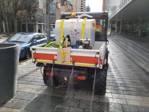
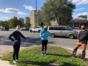
Ryerson Road Salt Reduction Pilot Project (World Wildlife Fund Canada Go Wild Community Grant, 2019)
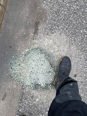
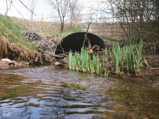
In the City of Toronto, more than 120,000 tonnes of road salt is applied each year. When snow and ice on our streets, sidewalks and parking lots melt, the salty runoff can have severe effects on our natural and built environments. Long-term salinization of groundwater and surface water (e.g., rivers, lakes, wetlands) pose risks to human and aquatic ecosystem health. In urban areas, stream salinity usually exceeds chronic toxicity thresholds for freshwater organisms, including certain species of endangered and special concern freshwater mussels. While the benefit of road salts for maintaining public safety is unequivocal, road salt usage is often higher than needed to achieve safe conditions. To reduce the risk that road salt poses to human and aquatic ecosystem health, the federal government developed a voluntary Code of Practice for the Environmental Management of Road Salt. The code recommends organizations that apply more than 500 tonnes of road salts per year develop salt management plans and implement best practices in salt application, salt storage and snow disposal. Many municipalities across Canada, including the City of Toronto, have adopted the code and implemented salt reduction strategies such as tracking salt usage and applying brine solutions before storms. Unfortunately, the code does not extend to private organizations such as shopping malls, or public facilities such as educational institutions.
The overall goals of this project are: 1) to evaluate the effectiveness of using anti-icing for reducing road salt usage on Ryerson University campus and 2) to promote road salt reduction to the public, private commercial property owners, water professionals, and policy/decision makers. In partnership with Ryerson University’s Facilities Management and Development (FMD) team, we will be implementing anti-icing methods on a portion of the paved surfaces on campus over the 2018-19 winter season. We will track the effectiveness of anti-icing for achieving bare pavement, the reduction in road salt usage and associated costs, and assess the feasibility of implementing anti-icing more widely across the campus. We will promote our project widely to the Ryerson University community, downtown property owners, water professionals, and government decision makers through a series of outreach and knowledge transfer events. Reducing our dependence on road salt is a critical step in protecting our vulnerable freshwater ecosystems. A local road salt reduction demonstration project will be invaluable for communicating this message to a broad audience and will help everyone envision a future with less salt
|
Hydrological and biogeochemical resilience of human-dominated watersheds (NSERC Discovery Grant, 2017-2021)
More than 50% of the world's population now lives in urban areas and this is projected to increase to 60% by 2030. Across scales, urbanization is characterized by increases in impervious surface area, reductions in water infiltration rates, and increases in surface runoff. These alterations to the natural landscape drastically alter the timing and magnitude of stream hydrological responses to precipitation inputs. When rain- or melt-water washes over impervious surfaces it collects pollutants and carries them into the stormwater-stream system leading to degraded water quality. To slow water down and prevent excess materials from reaching water bodies, stormwater control measures are often employed. Despite these efforts, the negative impacts of urban development on stream health remain and are now exacerbated by more frequent extreme weather events. The overall goal of this research program is to advance our understanding of the cumulative impacts of climate and land use changes on the hydrology and biogeochemistry of human-dominated (i.e. urban and urbanizing) watersheds. The short-term objectives of the research include: (1) Examining the influence of land use patterns on the hydro-biogeochemical behaviour of human-dominated watersheds, (2) Quantifying the impact of stormwater control measures on the hydro-biogeochemical behaviour of human-dominated watersheds, and (3) Assessing and comparing the hydrological and biogeochemical resilience of different human-dominated watersheds to extreme events. These objectives will be addressed through a variety of temporally and spatially intensive hydro-biogeochemical field sampling approaches in four meso-scale watersheds and their sub-catchments located in south-central Ontario. The study watersheds span a gradient of size and land use from highly urbanized to dominantly agricultural. Geospatial determination of effective, or hydraulically connected, impervious area and the quantification of multiple metrics of the spatial distribution of land use will be carried out for each watershed. Catchment hydrological functioning, specifically the proportion of 'new', event water leaving the catchment during storm events and the distribution of water ages leaving each watershed on multiple time scales, will be estimated using stable water isotopes. Catchment biogeochemical functioning will be assessed through the spatial analysis of key water quality data collected seasonally during synoptic longitudinal surveys of multiple headwater catchments (with and without stormwater management ponds) in the study watersheds. Lastly, statistical analyses of precipitation-runoff and solute concentration-discharge relations at the watershed-scale will be used to evaluate the resilience of different land use patterns to extreme weather events. This research will inform sustainable management of urban water resources in Canada. |
|
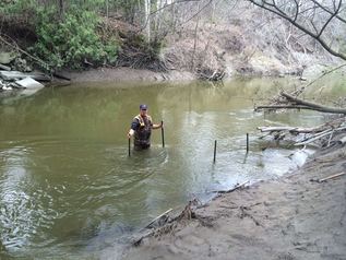
Longitudinal assessment of water quality during low and high flow conditions along Innisfil Creek in collaboration with Dr. Stephanie Melles (Environment Canada, Lake Simcoe/South-eastern Georgian Bay Clean-Up Fund, 2016-17)
Innisfil Creek, located in the southeastern region of the Nottawasaga River watershed, has long suffered from poor water quality, including high turbidity and phosphorus levels. Stream water quality changes from unimpaired where discharges from the Simcoe upland headwaters to impaired as the creek flows down into the Simcoe lowlands and joins the Nottawasaga River. The impacts of poor water quality along Innisfil Creek extend downstream into the Nottawasaga River and persist all the way to Wasaga Beach. Building on previous research, we are carrying out a temporally and spatially intensive water quality monitoring project to more fully understand the hydrologic- and land use-related controls on water quality in this system. To date, using the results of 9 longitudinal synoptic water quality surveys that spanned a range of flow levels (i.e. baseflow to stormflow), we have found positive linear concentration-discharge relationships for total suspended solids (TSS), total phosphorus (TP) and soluble reactive phosphorus (SRP), suggesting that the export of problematic sediment and excess nutrients from this watershed are exacerbated during high flow conditions that connect critical sources areas (e.g. agricultural fields) to the stream and promote erosion of stream banks. We expect that the results of this study will help inform land management practices and initiatives along the creek that could reduce the mobilization of sediment excess nutrients to the stream. Ongoing research in this watershed is focused on: (i) understanding the physical and hydrological processes that are responsible for mobilizing sediment and nutrients under varying flow conditions, (ii) using remotely sensed imagery to classify land use immediately adjacent to streams throughout the watershed and (iii) developing a spatially distributed model of nutrient export for the watershed. |
|
Fate and Transport of Chloride in Urbanizing Catchments of the Lake Simcoe/South-eastern Georgian Bay Watersheds (Environment Canada, Lake Simcoe/South-eastern Georgian Bay Clean-Up Fund, 2015-17) In seasonally frozen environments, de-icers (chloride salts) are widely used to maintain safe driving conditions on roads and other impervious surfaces. While the beneficial role of road salts for public safety is unequivocal, the environmental consequences of their use pose risks to stream and lake ecosystems. In the Lake Simcoe watershed (LSW), chloride (Cl) is listed as a pollutant of concern in the 2009 Lake Simcoe Protection Plan, and in-stream Cl concentrations have been increasing in most tributaries since 1993. In urbanized catchments of the LSW, stream Cl concentrations often exceed environmental protection guidelines set out by the Canadian Council of Ministers of the Environment during winter high flows and summer baseflow. However, there is uncertainty in how applicable the national guidelines are to Southern Ontario’s hard waters. Cl concentrations have not been extensively documented in the South-eastern Georgian Bay watershed (SGBW). The goal of this two year project is to improve our understanding of the dynamics and ecological effects of Cl across a gradient of urbanizing catchments in the LSW and SGBW. The results of this study will help to inform adaptive winter maintenance management strategies for the LSW and SGBW and identify salt vulnerable areas to be protected. |
|
Mercury Cycling in a Constructed Wetland in the Athabasca Oil Sands Region In the Athabasca Oil Sands Region in northeastern Alberta, Canada, oil sands operators are testing the feasibility of peatland construction on the post-mining landscape. This study examined the effects of hydrological management and elevated sulfate levels on mercury fate and transport in a 52 ha constructed wetland system on the Syncrude Canada Ltd. mine property. The study was conducted in collaboration with Dr. Sean Carey at McMaster University. |
|
Mercury Experiment to Assess Atmospheric Loading in Canada and the U.S. (METAALICUS) This research examined the hydrological and landscape controls on the fate and transport of ambient and applied mercury isotope in the terrestrial uplands of the METAALICUS watershed at the Experimental Lakes Area. This research was conducted under the supervision of Dr. Brian Branfireun at the University of Toronto (now at Western University). |